
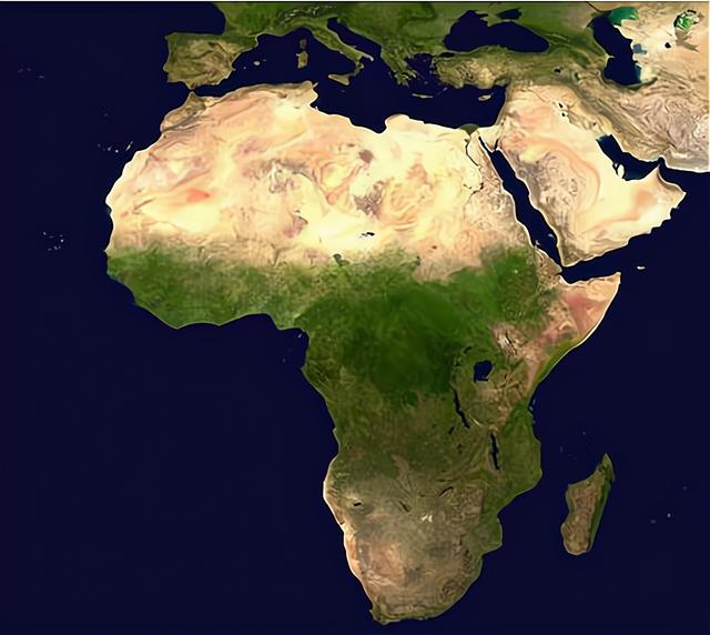
As the largest sandy desert on earth, the sahara desert is well known. This huge desert in northern africa, stretching from the atlantic coast in the west to the shores of the red sea in the east, covers an area of around 9.32 million square kilometres and its natural environment is so harsh that it is considered one of the most unfriendly areas on earth to life.
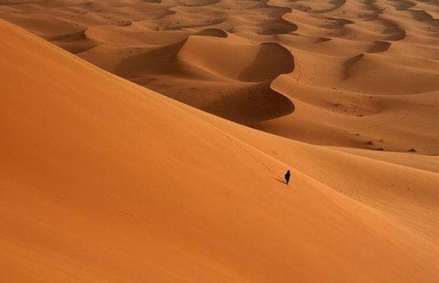
As a whole, the sahara desert is a world of sand, and if you were in the depths of this desert, you would see endless stretches of sand stretching to the sky, and the sand beneath your feet would be bottomless. Of course, "Bottomless" Is an exaggeration, but how deep is the sahara? Well, it can be measured.
Generally speaking, we can measure the shallow desert directly by drilling and digging, but for a desert of the size of the sahara, this method is obviously not suitable. We can use a radar system to do this.
This method simply involves emitting specific electromagnetic waves into the desert subsurface, then detecting and recording the waveform characteristics of the waves reflected back from the different interfaces in the subsurface, and then processing this data through the relevant techniques to obtain a radar profile and thus the depth of the desert.

The average depth of the sahara desert is about 150 metres (up to 320 metres) according to the current known detection data. If we calculate the height of one floor at 3 metres, then the average depth of the sahara desert is equivalent to 50 floors, which is very exaggerated.
If you were to dig up all the sand in the sahara desert, what would be underneath?
The main reason for the formation of the desert is drought, the process of which can be simply described as follows: Drought causes no (or very little) vegetation to survive on the surface, and without the protection of vegetation, the surface is directly exposed to weathering, in which case the rocks on the surface are constantly being weathered into debris and gravel, and the soil on the surface is constantly losing moisture, eventually turning into grains of very small sand, and over time, large areas of desert are formed.
If we keep digging in the desert, we will find that the grains of sand increase in size with depth and gradually turn into larger and larger gravel and gravel heads, and if we dig deep enough, sooner or later we will find completely unweathered rock.
This intact rock, which lies beneath the weathered surface of the earth's crust, is known as 'bedrock', which is generally composed of sedimentary, magmatic and metamorphic rocks, and when we dig here, we can assume that we have reached the bottom of the desert.
So, if we were to dig up all the sand in the sahara, we would be able to see the 'bedrock' of the desert. It is important to note that this is only an answer in terms of material composition, but in terms of the overall topography, there are in fact the remains of ancient riverbeds and lakes buried beneath the sands of the sahara.
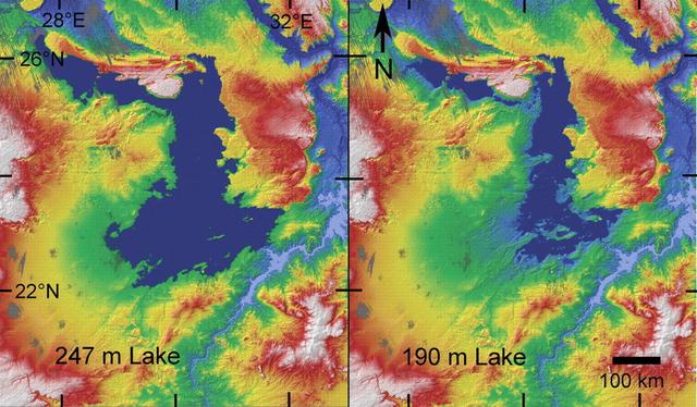
The map above is a satellite map produced by scientists based on data from the synthetic aperture radar carried by the space shuttle columbia, which shows that at the bottom of the sahara desert there are the remains of a huge ancient lake, estimated to have covered an area of 108,000 square kilometres at its height and to a depth of 247 metres, and even at its lower levels it covered 48,000 square kilometres and had a depth of around 190 metres.
(synthetic aperture radar (sar) is an earth observation system with some surface penetration capability that allows imaging of the earth's surface from high altitudes)
In fact, scientists have now discovered the remains of a number of ancient riverbeds and lakes beneath the sahara desert, the remains of that lake mentioned above being just one of them.
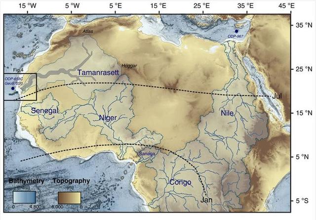
(the map above shows part of the ancient river system located at the bottom of the sahara desert)
Research has shown that the sahara desert has not always been a desert, but has in fact been a region that has shifted between an arid desert and a wet oasis over time (the last 'oasis period' ended some 5,000 to 6,000 years ago), and scientists have speculated that this situation is likely to be the result of "The last 'oasis period' ended some 5,000 to 6,000 years ago.
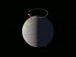
As shown in the diagram above, the earth's axis of rotation rotates regularly under the gravitational influence of the sun and the moon, and this is known as 'earth-entry', with a period of about 25,700 years.
Scientists theorise that the earth's 'earth-entry' causes periodic changes in the solar energy received by the region of the sahara desert and its adjacent oceans, causing the summer winds to regularly 'change from weak to strong and then from strong to weak', and when the summer winds become stronger when the summer winds become stronger, the area is transformed into a humid oasis, and vice versa into an arid desert.


